Confidently Plan and Estimate Works Site With Drone
Trimble Stratus software helps civil contractors use drones to map, measure and share accurate information about their worksites and assets. With Stratus, you can make quicker decisions, avoid mistakes, and grow profits by always having the right information on hand.
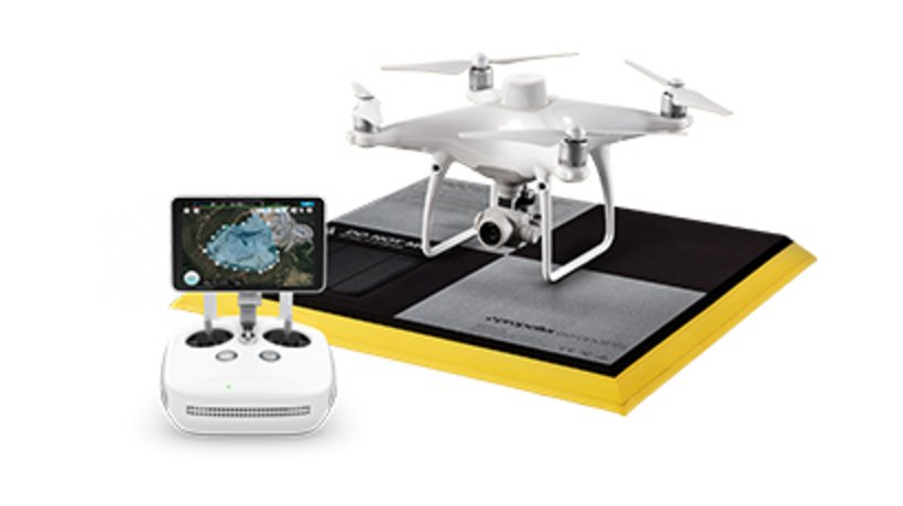
How it works

Features and Benefits
Plan and Estimate
- Know what you’re quoting: Conduct your own site surveys before the job begins, and whenever changes occur
Survey Frequently and Faster
- Get accurate, up-to-date topographic surveys whenever you need without having to bring in a survey crew
Communicate Effectively
- A visual timeline keeps everyone on the same page
- Track site changes, avoid crossed wires, and resolve disputes quickly
Take Control
- Save on consultants and avoid information bottlenecks; get answers to questions yourself with an intuitive, web-based tool
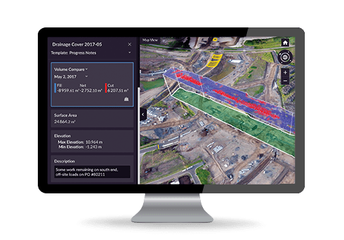
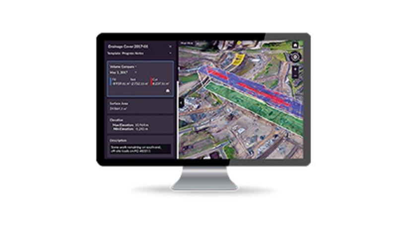
Site Volumes
- Calculate overall material volumes added or removed from pits, stockpiles, cells, drainage channels, etc.
Design Checks
- Upload design file to compare actual surface to design surface and track progress
- Easily measure distances, slopes and heights to compare with site measurements

Site Management
Subcontractor Management
- Trimble StratusPerform quick volume calculations of material moved for progress payments
- See proof of site changes via a visual timeline
- Fewer disputes as your portal can be shared with subcontractors so everyone is on the same page
Road and Traffic Management
- Measure road grades, cross-slopes, road widths and windrow heights with one click
- Optimize traffic plans with a complete, up-to-date site map, and easily direct personnel to where they need to be
- Reduce cycle times and optimize mobile plant efficiency by tracking haul road design conformance
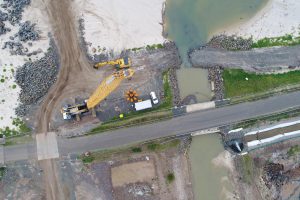
Environmental Responsibilities and Safety
- Get frequent, detailed images of site boundaries and protected areas to easily demonstrate your conformance with regulatory requirement
- Reduce people-to-machine interactions by surveying inaccessible or hazardous areas safely using a drone
- Get overall site images for inspection works, without sending personnel on-site
- Track changes in slope angles to better manage slips
Project Efficiency
- Software for consistent local coordinate definition
- Conduct your own site surveys for more accurate estimates
- Tighter plans and budgets as a result of more frequent and accurate volume data
- Fewer site visits needed when people can track progress and inspect work remotely
- No more information silos or unnecessary hold-ups when everyone can work from the same current survey data